Lower Yahara River Trail
The Lower Yahara River Trail is a short, but scenic path in the Madison metropolitan area. The trail is managed by Dane County Parks Department. It travels through Madison, Blooming Grove, and McFarland. The trail also journeys through William G. Lunney Lake Farm County Park, and crosses an expansive boardwalk bridge by Lake Waubesa. Its western terminus links to the Capital City State Trail, allowing for a longer ride. Opened in 2017, there are plans to extend the trail further south to Lake Kegonsa and Stoughton.
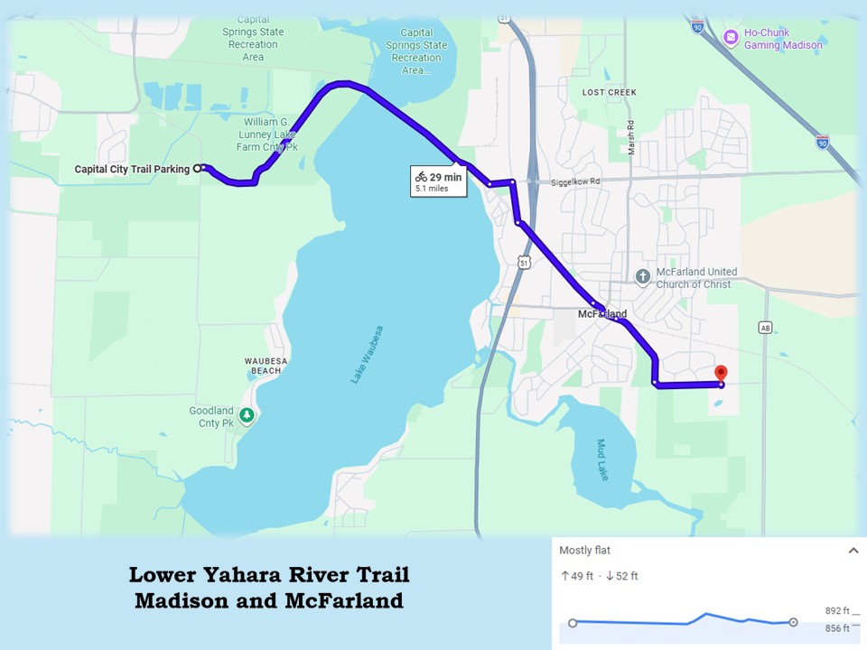
Traveling only 5.1 miles, the Lower Yahara River Trail offers delightful views of marshlands, meadows, and hardwood forests that surround the Yahara River and Lake Waubesa. The surface of the path is paved with asphalt, in excellent condition. A center line helps control the flow of traffic. The route follows a city street for 0.3 mile in a marked bike lane. The elevation is fairly level, with one 50 foot hill along the way. Two spur trails diverge from the Lower Yahara River Trail, offering the opportunity to extend a ride.
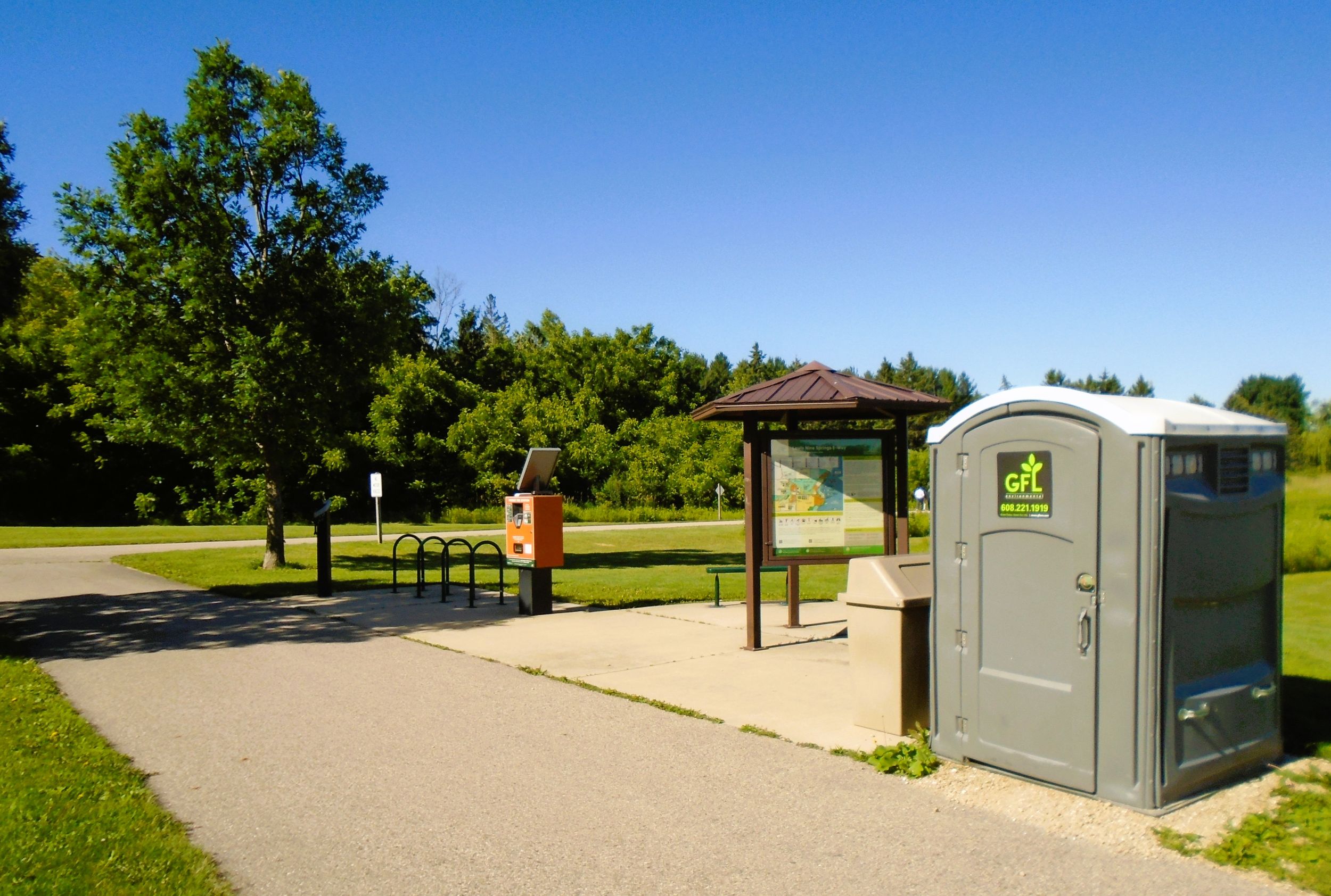
The western trailhead for the Lower Yahara River Trail also serves the Capital City State Trail. To access it by car, take exit 264 south from Madison’s Beltline (U.S. Highways 12-18) on South Towne Drive. It then becomes Raywood Drive. After 0.7 mile, turn left (east) onto Moorland Road. It becomes Lake Farm Road. The trailhead is on the right (west) side of the road 1.4 miles from the Beltline. It has a parking lot, self-registration station, portable toilet, bike rack, self-service bicycle repair station, park benches, and information kiosk.
The Lower Yahara River Trail advances through Capital Springs State Recreation Area in its first two miles. Spanning 2,700 acres, Capital Springs is managed by Dane County Parks and the Wisconsin DNR. It offers a wide variety of outdoor recreational activities. William G. Lunney Lake Farm County Park and the Lussier Family Heritage Center are both connected to Capital Springs State Recreation Area and next to the Lower Yahara River Trail.
Numerous amenities are offered at Capital Springs State Recreation Area and Lunney Lake Farm County Park. In addition to paved bike trails, there are mountain bike paths, hiking trails, boat and canoe/kayak launch sites, fishing piers, athletic fields, playgrounds, disc golf course, dog exercise areas, observation tower, picnic pavilions, restrooms and showers, and a campground with electric and water hook-up. Lussier Family Heritage Center offers environmental educational programs, and serves as a scenic wedding venue.
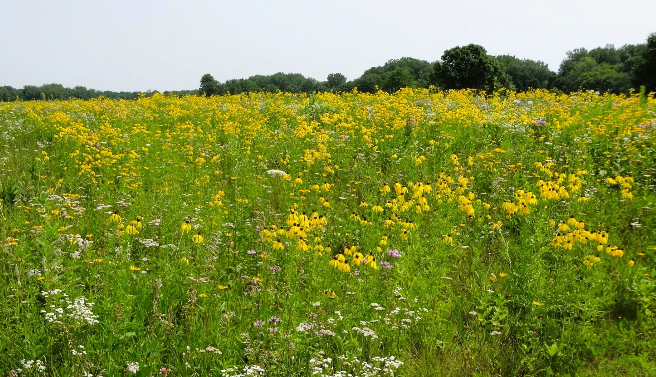
Capital Springs State Recreation Area is a premier bird-watching destination. Amateur ornithologists shouldn’t forget binoculars when heading out on the trail. A variety of shore birds, waterfowl, migratory birds, wetland and grassland birds, and raptors are commonly seen. It is always exciting to spot a bald eagle or osprey. During summer months, brilliantly colored wildflowers grow by the trail in meadows. These include wild bergot (Monarda fistulosa), black-eyed Susans (Rudbeckia hirta), and compass plants (Silphium laciniatum).
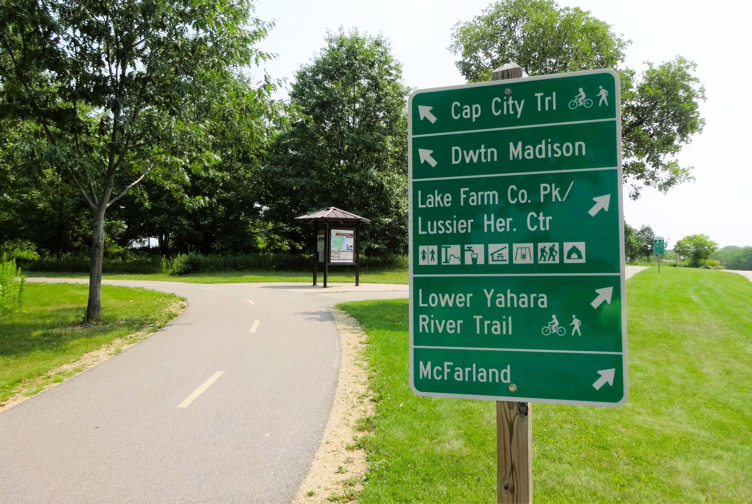
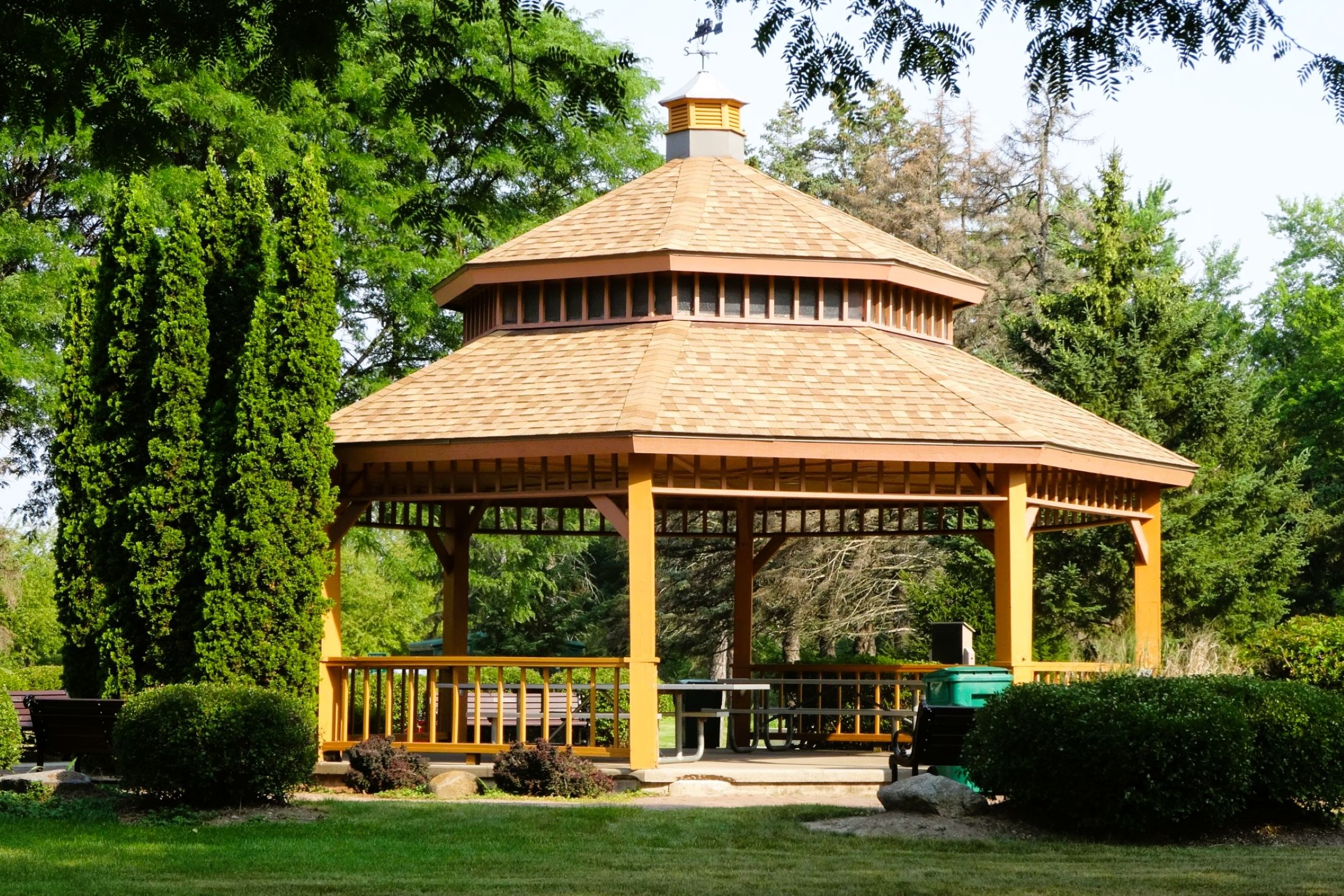
Back on the Lower Yahara River Trail, the path begins at an information kiosk on the east side of Lake Farm Road. From the trailhead, cyclists take Capital City State Trail left (east) across the road. At the kiosk is the start of the Lower Yahara River Trail. It goes straight (east). Signs mark the direction of the two trails and different facilities. Continuing east, the path crosses the entrance to Lussier Family Heritage Center and travels by Lunney Lake Farm County Park campground. A large pavilion there is on the right (south) side of the trail.
Continuing on its way, the path makes several small turns, but proceeds to the northeast. It travels through oak savannas and mixed hardwood forests. To the left (north) are low wetlands surrounding Nine-Mile Creek. Cattails and reeds grow throughout the marsh. The trail also passes through open meadows. In the summer, beautiful wildflowers bloom there.
A half mile from the start, two spur trails go off to the right. The first trail goes straight south. This is the paved West Waubesa Trail that travels about a mile south. From its end on Waucheeta Trail, its another mile on this town road to Goodman Park. The other spur trail goes a short distance east to the facilities of William G. Lunney Lake Farm County Park. Picnic shelters, playgrounds, and an observation tower are located there. A half mile further up the main trail, a gravel road heads off to the right (east) to the park’s group campground.
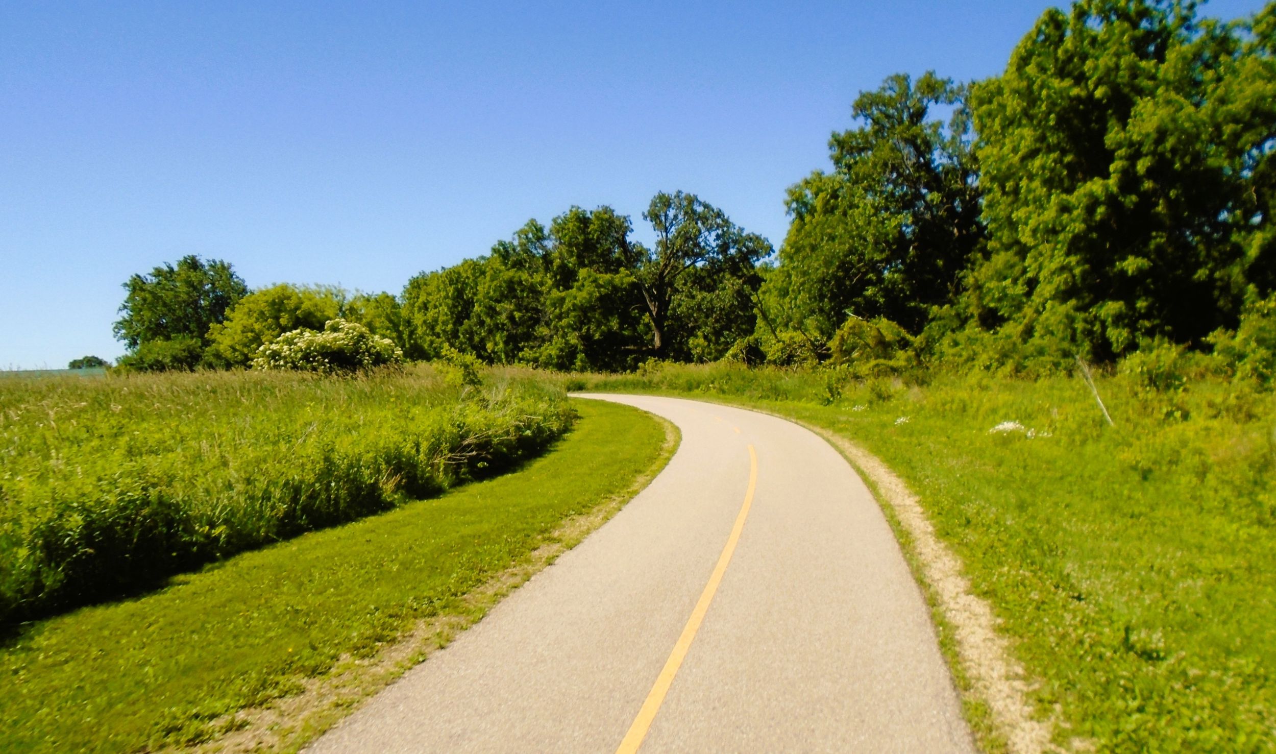
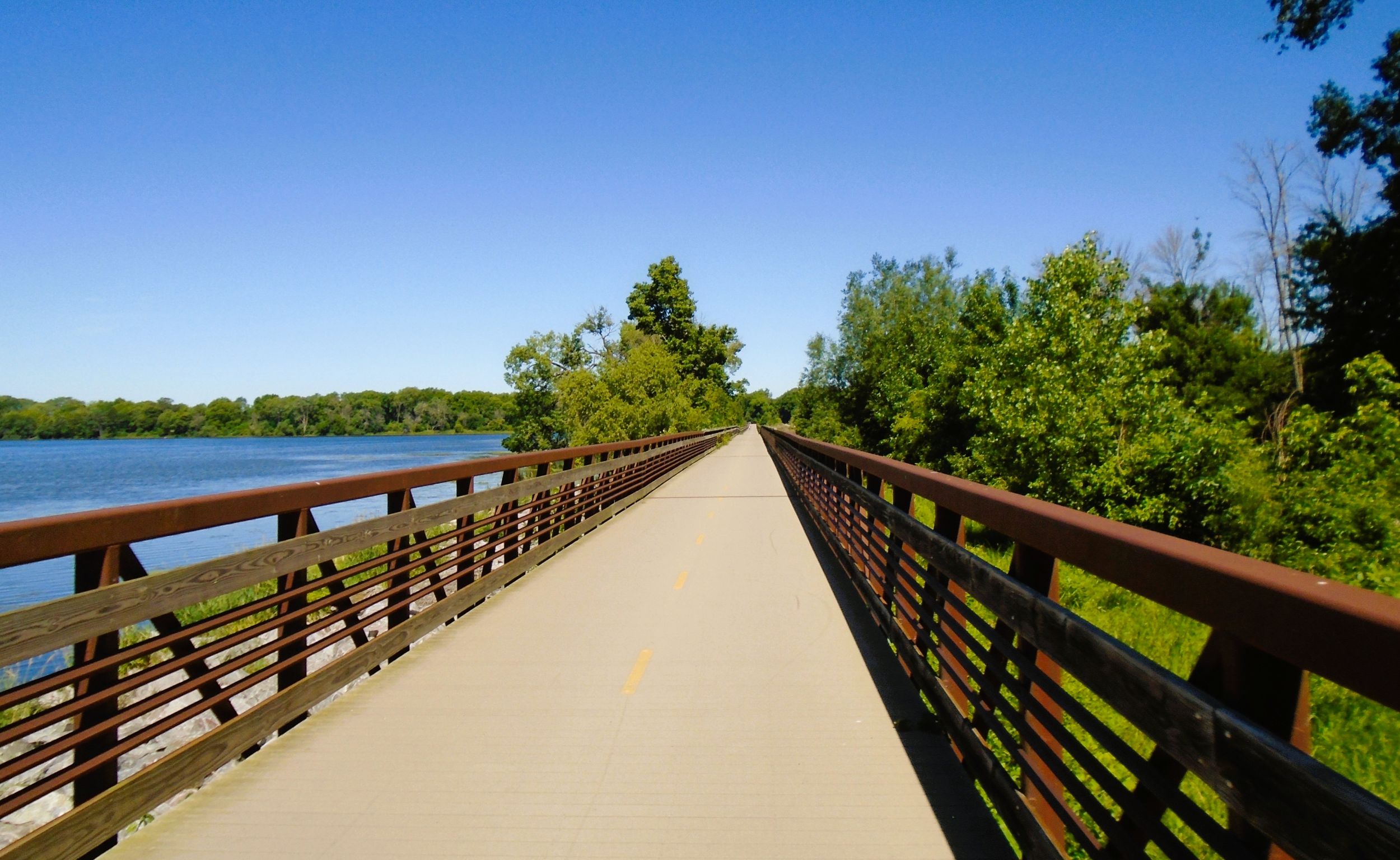
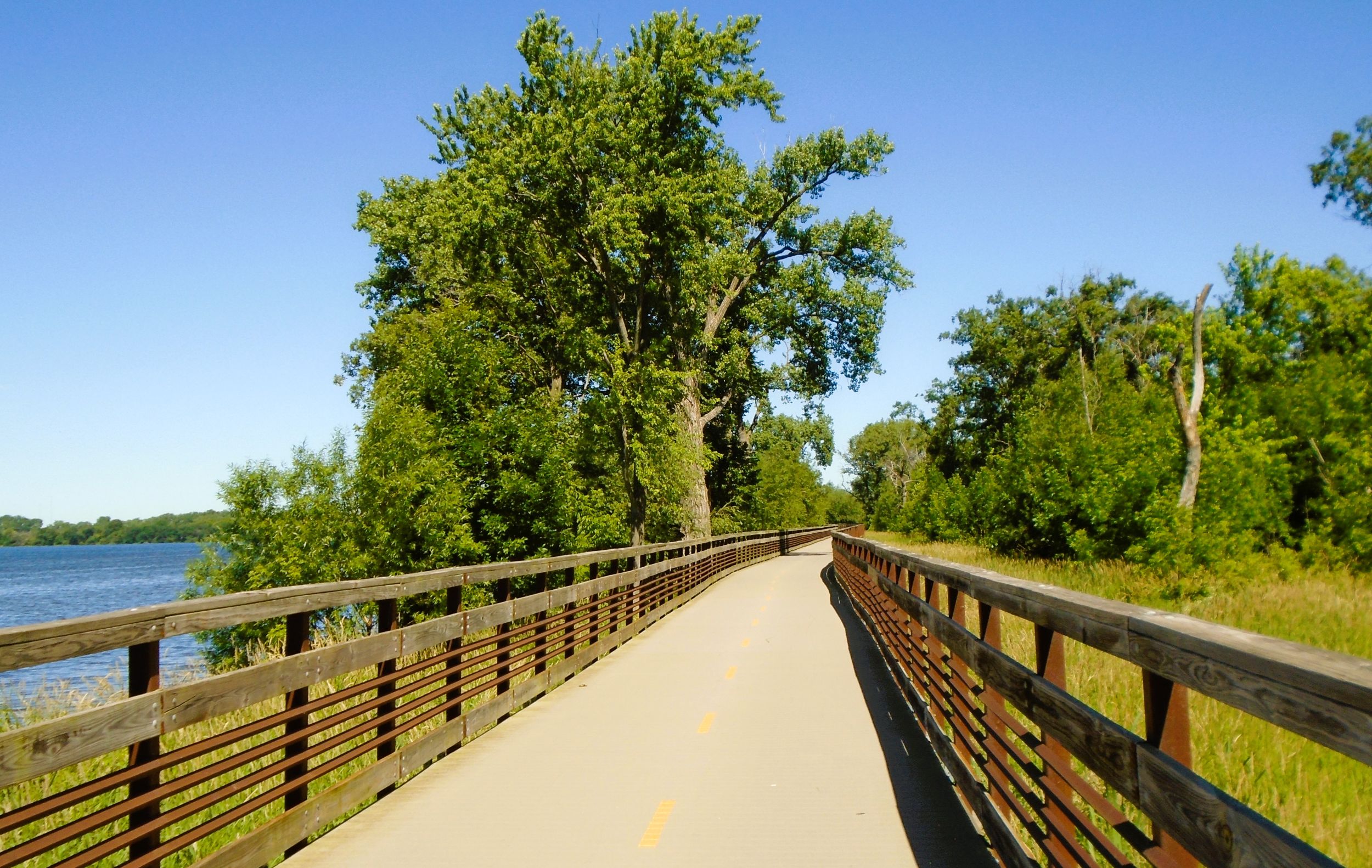
After passing the group campsite road, the trail passes through a forest of oak and cottonwood trees. Markers name the tree species, and wildflowers line the trail. For a half mile, the path arcs to the southeast. The forest then falls away, and the trail ventures out along the shore of Lake Waubesa on a boardwalk nearly a mile long. Dane County Parks Department claims that this is the longest inland boardwalk bridge in North America built exclusively for non-motorized vehicles. It certainly is the longest boardwalk within the state.
Running parallel to a railroad corridor, the boardwalk crosses the Yahara River. The narrow river flows through four lakes: Mendota, Monona, Waubesa, and Kegonsa. To the left (north) of the boardwalk is Upper Mud Lake. It is hard to see this lake due to the railroad causeway. But the the view of Lake Waubesa to the right (south) is unencoumbered. The lengthy boardwalk has a fishing pier and several pull-out observation areas. These are the perfect place to watch boating activity on the lake or look for waterfowl and raptors. The view of the lake and countryside from the observation areas is completely stunning and worth the stop.
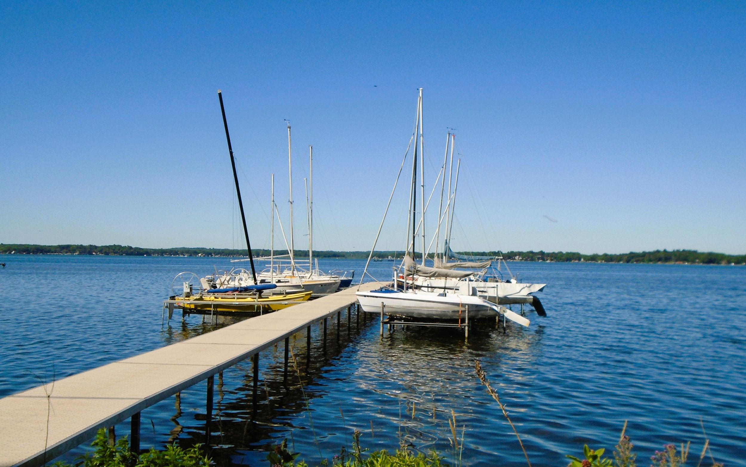
The boardwalk comes to an end at McDaniel Park in McFarland. Situated on the shores of Lake Waubesa, the park is well-equipped. It has restrooms, drinking water, covered picnic shelter, grills, and playground. It also has a bike rack and self-service bicycle repair station. Sailing boats line the dock; the park is home to the Waubesa Sailing Club. The beautiful setting of McDaniel Park lures trail-goers to stop and enjoy the amazing scenery there.
It is only a 2.5-mile ride from the trailhead by William G. Lunney Lake Farm County Park to McDaniel Park in McFarland. This part of the trail is safe, scenic, and fairly level in elevation. It’s an ideal ride for families with young children. Both parks, on either end of the trail, have picnic shelters and playgrounds. This section of the path does see a lot of use, however. It can be busy even on weekdays. There is a fair amount of pedestrian traffic on the trail. Bicyclists should use caution when approaching and passing them.
McDaniel Park works well as a trailhead. To reach the park by car from Madison’s Beltline (U.S. Highways 12-18), take exit 266 south on U.S Highway 51 (Stoughton Road). Drive 1.3 miles, and take the exit right (west) on Siggelkow Road. Turn right (west) and drive 350 yards to McDaniel Lane. Turn right (north) on McDaniel Lane and enter the parking lot.
The Lower Yahara River Trail continues on past McDaniel Park. It travels south next to McDaniel Lane for a short distance before meeting Siggelkow Road. There, it turns left (east) and runs adjacent to that road. Caution should be used when crossing the railroad tracks there. The trail passes Brandt Park. It has ballfields, a picnic shelter, and playground.
The trail appears to end at Siggelkow Road and Terminal Drive, but the route continues to the right (south). It travels on Terminal Drive for 0.3 mile in a bike lane. At the intersection with Taylor Road, the path picks up again on the east side of the street. It travels southeast, parallel to the Taylor Road, and downhill. After 0.8 mile, it arrives at quaint Arnold Larson Park. This downtown park has a scenic gazebo, picnic tables, drinking fountain, and benches. The trail traverses the park and crosses Exchange Street.
Cyclists wanting to visit some of McFarland’s downtown shops should turn left (north) on Exchange Street. It’s less than 300 feet to the historic McFarland House. Now listed on the National Register of Historic Places, this Greek Revival architectural-styled house was constructed in 1857. The McFarland House Café and Lily’s Ice Cream Parlour are located there. Trailgoers may enjoy a variety of coffee drinks, sandwiches, and baked goods. 28 flavors from Madison’s Chocolate Shoppe Ice Cream Company also tempt visitors.
The Lower Yahara River Trail crosses Exchange Street and moves through another potential trailhead location. A Dane County historical marker is found there. It conveys the origins and history of the village of McFarland. There also is a self-service bicycle repair station, bike rack, and parking lot. The lot is accessed from Bashford Street. By car, drive east on Farwell Street 0.7 mile from U.S. Highway 51 in McFarland. After crossing Exchange Street, the road becomes Bashford Street, and that’s where the parking lot is located.
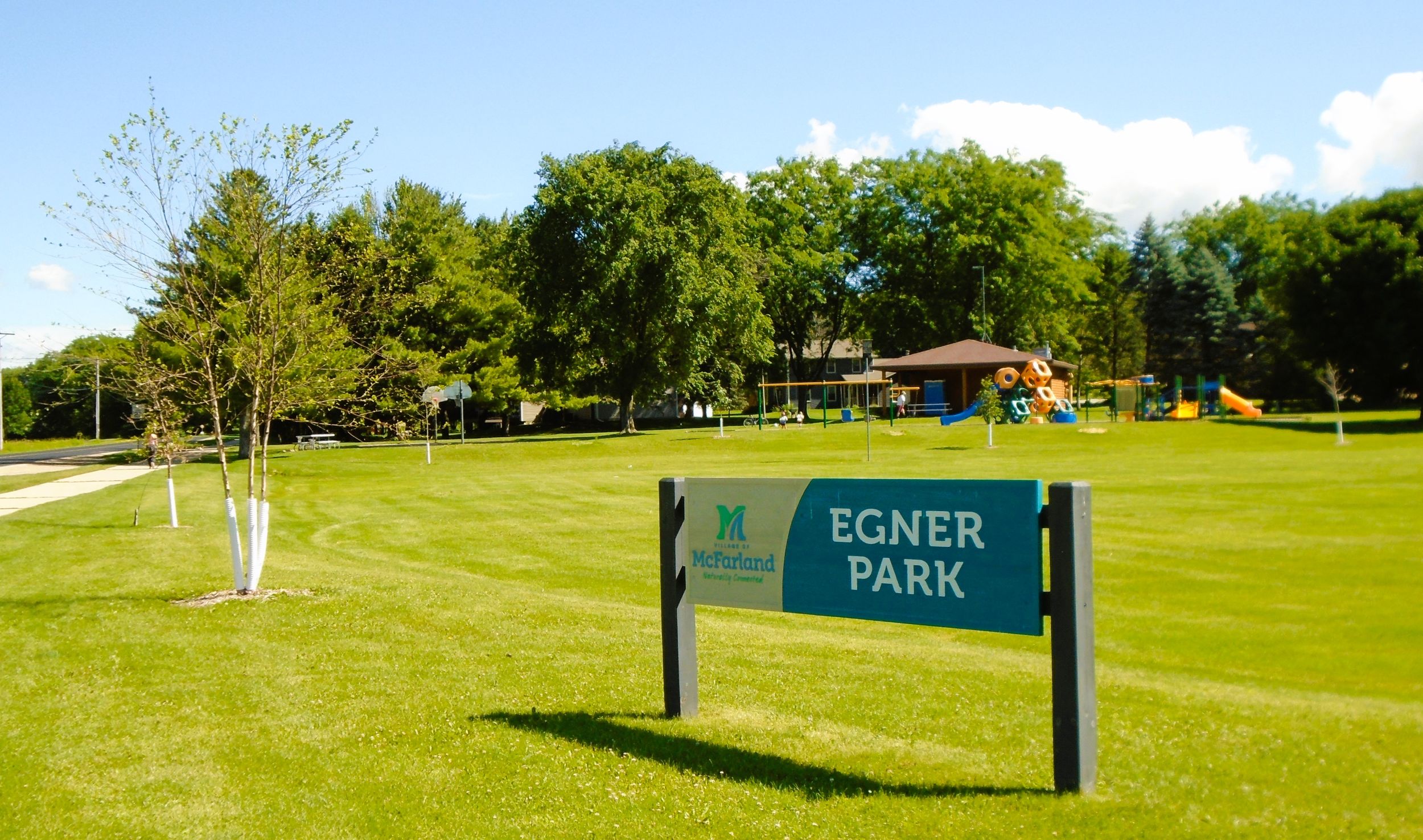
Continuing southeast next to Bashford Street, the Lower Yahara River Trail next crosses Milwaukee Street. Bashford Street becomes Creamery Road, which the trail follows. It travels through a residential area, but also goes by a wetland area in Grandview Park. A half mile from Milwaukee Street, the trail passes Egner Park. It has a covered shelter, picnic tables, and playground. Egner Park has street parking off Bird Song Court.
Where Creamery Road turns left (east), it becomes Elvehjem Road. Grandview Trail branches off from the main path and crosses the road there to the right (west). This spur trail cuts across Grandview Park, travels 350 yards, and ends at a local McFarland neighborhood.
The Lower Yahara River Trail continues east adjacent to Elvehjem Road for its last half mile. Urso Park sits across the road to the right (south) from the trail’s end point. It is mainly a dog park, but has public restrooms, drinking water, and a parking lot. The park serves well as a trailhead. To reach Urso Park by car, turn east on Farwell Street from U.S. Highway 51 (Stoughton Road) in McFarland. The road turns into Bashford Street, Creamery Road, and finally Elvehjem Road. Drive 1.8 miles. The park is on the right (south) side of the road.
It’s a pleasant bicycle ride through the village of McFarland. Founded in 1856 by William McFarland, its early industries were wheat and tobacco farming. Harvesting winter ice and fish on Lake Waubesa were other main businesses. A small resort industry also developed along the shores of the lake. Today, the village is a bedroom community of Madison.
A ride on the Lower Yahara River Trail is slightly over five miles long. Highlights along the route include passing through the natural beauty of William G. Lunney Lake Farm County Park and traveling on the nearly one-mile long boardwalk by Lake Waubesa. Adding to the enjoyment of the ride is stopping for a tasty treat at the McFarland House.
Map of trailheads and addresses along this section of the trail.
Future plans by Dane County Parks Department call for the Lower Yahara River Trail to extend south to Stoughton. Currently, a 1.6-mile section is open. It runs from Fish Camp County Park east to the white oak parking lot in Lake Kegonsa State Park. The path moves through the wetlands of Door Creek Wildlife Area, along the north shore of Lake Kegonsa.
Trail last ridden and documented in June, 2026.